
Schema
The vector tile schema describes how the vector data is organized into different thematic layers and which attributes and values each layer contains. This is useful for writing a map style and allows for alternative implementations of a schema.
The OpenMapTiles schema is open (CC-BY) and you are free to use, extend, or build upon the existing implementation (BSD license). Attribution is required. Please properly reference OpenMapTiles if you build upon the schema.
The vector tile schema has been developed by Klokan Technologies GmbH and was initially modeled after the cartography of the Carto Basemap Positron. The vector tile schema has been refined and improved in cooperation with the Wikimedia Foundation and is heavily influenced by Paul Norman's many years of experience creating maps from OpenStreetMap.
Schema updates and data changelog.
aerodrome_label


SELECT id, geometry, name, name_en, name_de, NULLIF(tags->'name_int', '') AS "name_int", NULLIF(tags->'name:latin', '') AS "name:latin", NULLIF(tags->'name:nonlatin', '') AS "name:nonlatin", class, iata, icao, ele, ele_ft FROM layer_aerodrome_label(ST_SetSRID('BOX3D(-20037508.34 -20037508.34, 20037508.34 20037508.34)'::box3d, 3857), 14)Fields
name
The OSM name value of the aerodrome. Language-specific values are in name:xx.
name_en
English name name:en if available, otherwise name. This is deprecated and will be removed in a future release in favor of name:en.
name_de
German name name:de if available, otherwise name or name:en. This is deprecated and will be removed in a future release in favor of name:de.
class
Distinguish between more and less important aerodromes.
Class is derived from the value of
aerodrome
and aerodrome:type tags.
Possible values:
internationalpublicregionalmilitaryprivateother
iata
3-character code issued by IATA.
icao
4-character code issued by ICAO.
ele
Elevation (ele) in meters.
ele_ft
Elevation (ele) in feet.
aeroway
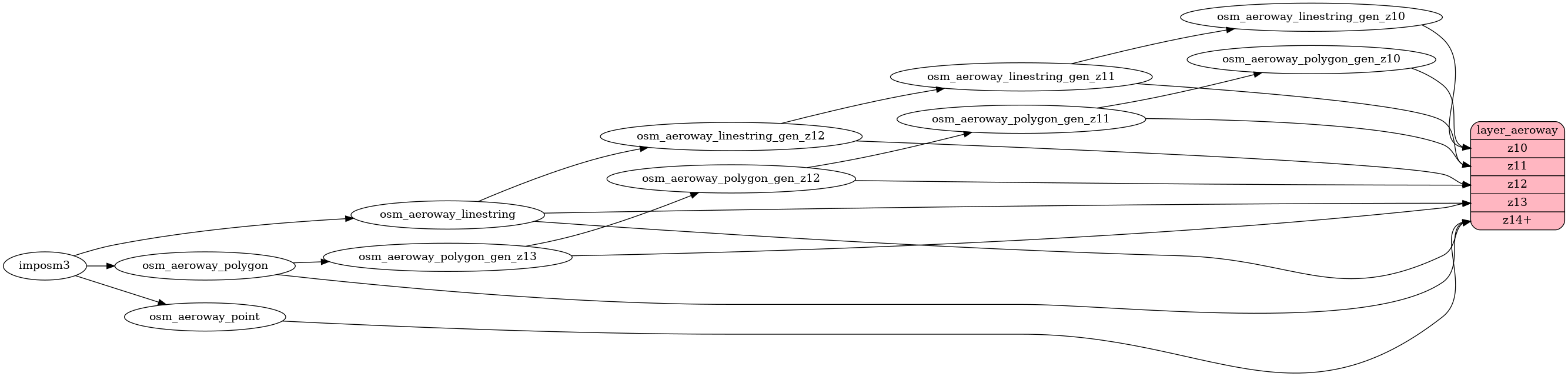
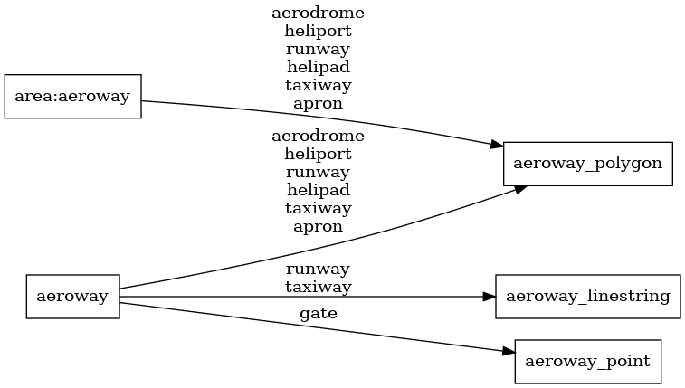
SELECT geometry, ref, class FROM layer_aeroway(ST_SetSRID('BOX3D(-20037508.34 -20037508.34, 20037508.34 20037508.34)'::box3d, 3857), 14)Aeroway polygons based on OpenStreetMap aeroways. Airport buildings are contained in the building layer, but all other airport-related polygons can be found in the aeroway layer.
Fields
ref
The OSM ref tag of the runway/taxiway.
class
The original value of
aeroway or
area:aeroway tag.
Possible values:
aerodromeheliportrunwayhelipadtaxiwayaprongate
boundary
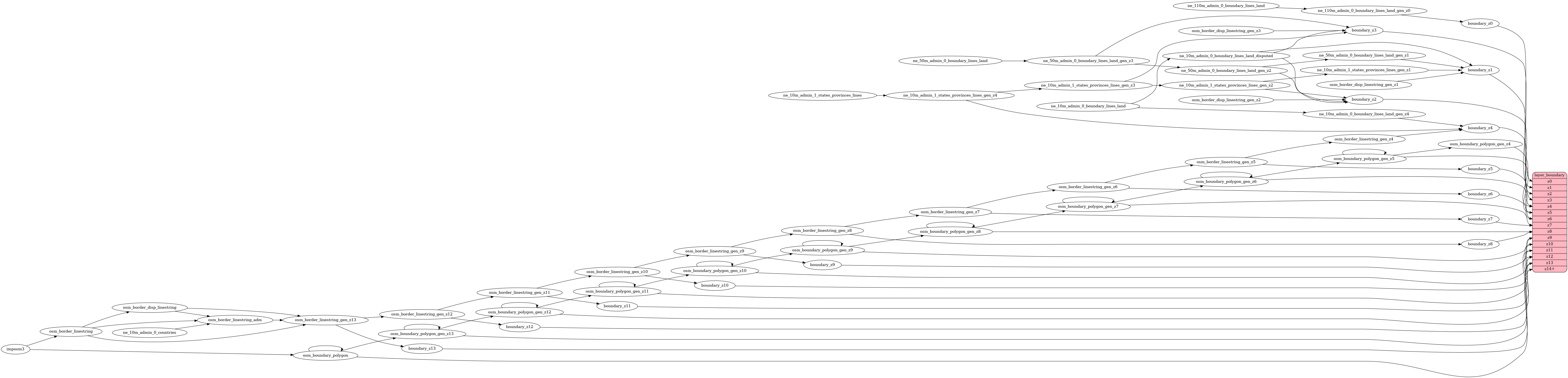
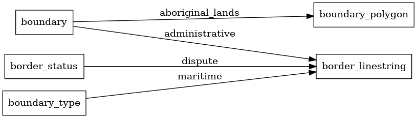
SELECT geometry, admin_level, adm0_l, adm0_r, disputed, disputed_name, claimed_by, maritime, class, name, NULLIF(tags->'name_int', '') AS "name_int", NULLIF(tags->'name:latin', '') AS "name:latin", NULLIF(tags->'name:nonlatin', '') AS "name:nonlatin" FROM layer_boundary(ST_SetSRID('BOX3D(-20037508.34 -20037508.34, 20037508.34 20037508.34)'::box3d, 3857), 14)Contains administrative boundaries as linestrings and aboriginal lands as polygons.
Until z4, Natural Earth data is used, after which
OSM boundaries (boundary=administrative)
are present from z5 to z14 (also for maritime boundaries with admin_level <= 2 at z4).
OSM data contains several admin_level values,
but for most styles it makes sense to just style admin_level=2 and admin_level=4.
Fields
class
Use the class to differentiate between different kinds of boundaries. The class for boundary=aboriginal_lands is aboriginal_lands.
name
The OSM name value (area features only).
admin_level
OSM admin_level
indicating the level of importance of this boundary.
The admin_level corresponds to the lowest admin_level
the line participates in.
At low zoom levels, the Natural Earth boundaries are mapped to the equivalent admin levels.
adm0_l
State name on the left of the border. For country boundaries only (admin_level = 2).
adm0_r
State name on the right of the border. For country boundaries only (admin_level = 2).
disputed
Mark with 1 if the border is disputed.
Possible values:
01
disputed_name
Field containing the name of the disputed area (extracted from border relation in OSM, without spaces).
For country boundaries only (admin_level = 2).
Value examples from the Asian OSM PBF extract.
Possible values:
AbuMusaIslandBaraHotiiValleysChineseClaimCrimeaDemchokDokdoIndianClaim-NorthIndianClaimwesternKashmirPakistaniClaimSamduValleysTirpaniValleys
claimed_by
ISO2 code of the country that wants to see the boundary line.
For country boundaries only (admin_level = 2).
maritime
Mark with 1 if it is a maritime border.
Possible values:
01
building

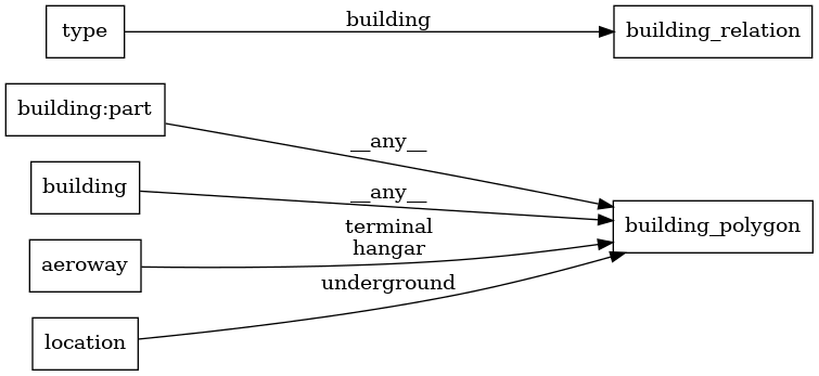
SELECT osm_id, geometry, render_height, render_min_height, colour, hide_3d FROM layer_building(ST_SetSRID('BOX3D(-20037508.34 -20037508.34, 20037508.34 20037508.34)'::box3d, 3857), 14)All OSM Buildings. All building tags are imported (building=*).
Only buildings with the location:underground tag are excluded.
Fields
render_height
An approximated height from levels and height of the building or building:part.
render_min_height
An approximated height from minimum levels or minimum height of the bottom of the building or building:part.
colour
Color
hide_3d
If true, the building (part) should not be rendered in 3D. Currently, building outlines are marked as hide_3d.
housenumber


SELECT geometry, housenumber FROM layer_housenumber(ST_SetSRID('BOX3D(-20037508.34 -20037508.34, 20037508.34 20037508.34)'::box3d, 3857), 14)Everything in OpenStreetMap that contains an addr:housenumber tag, useful for labeling house numbers on a map.
This adds significant size to z14. For buildings, the centroid of the building is used as the housenumber.
Duplicates within a tile are dropped if they have the same street/block_number (records without a name tag are prioritized for preservation).
Fields
housenumber
Value of the addr:housenumber tag. If there are multiple values separated by semicolons, the first and last values are joined with a dash.
landcover
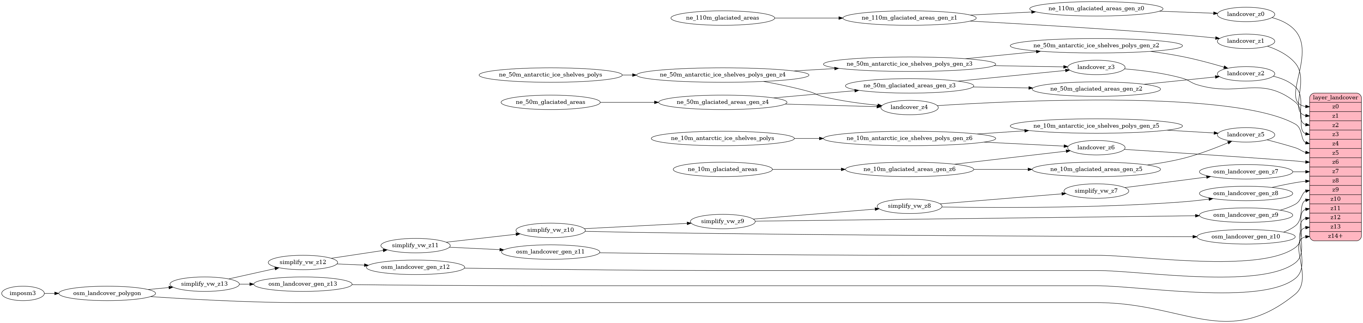
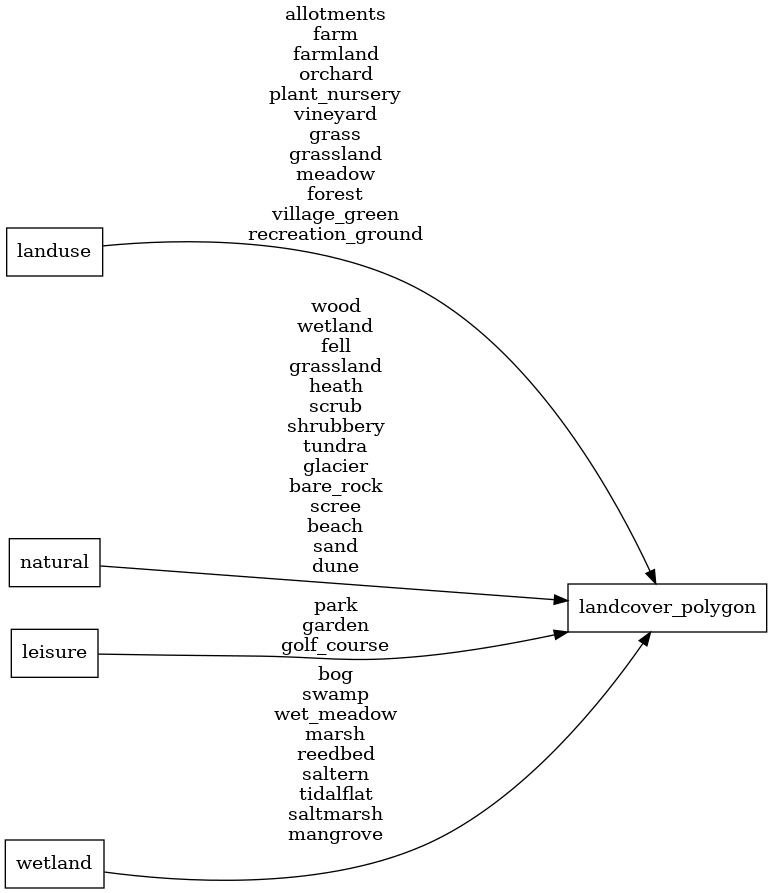
SELECT geometry, class, subclass FROM layer_landcover(ST_SetSRID('BOX3D(-20037508.34 -20037508.34, 20037508.34 20037508.34)'::box3d, 3857), 14)Landcover is used to describe the physical material at the surface of the Earth. At lower zoom levels, this is
from Natural Earth data for glaciers and ice shelves, and at higher zoom levels the landcover is implied by OSM tags. The most common use case for this layer
is to style wood (class=wood) and grass (class=grass) areas.
Fields
class
Use the class to assign natural colors for landcover.
Possible values:
farmlandicewoodrockgrasswetlandsand
subclass
Use subclass to do more precise styling.
Original value of either the
natural,
landuse,
leisure,
or wetland tag.
Possible values:
allotmentsbare_rockbeachbogdunescrubshrubberyfarmfarmlandfellflowerbedforestgardenglaciergrassgrasslandgolf_courseheathmangrovemarshmeadoworchardparkplant_nurseryrecreation_groundreedbedsalternsaltmarshsandscreeswamptidalflattundravillage_greenvineyardwet_meadowwetlandwood
landuse

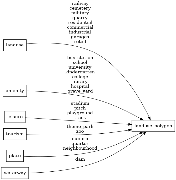
SELECT geometry, class FROM layer_landuse(ST_SetSRID('BOX3D(-20037508.34 -20037508.34, 20037508.34 20037508.34)'::box3d, 3857), 14)Landuse is used to describe the use of land by humans. At lower zoom levels, this is
from Natural Earth data for residential (urban) areas and at higher zoom levels mostly OSM landuse tags.
Fields
class
Use the class to assign special colors to areas.
Original value of either the
landuse,
amenity,
leisure,
tourism,
place,
or waterway tag.
Possible values:
railwaycemeterymilitaryresidentialcommercialindustrialgaragesretailbus_stationschooluniversitykindergartencollegelibraryhospitalstadiumpitchplaygroundtracktheme_parkzoosuburbquarterneighbourhooddamquarry
mountain_peak

SELECT osm_id, geometry, name, name_en, name_de, NULLIF(tags->'name_int', '') AS "name_int", NULLIF(tags->'name:latin', '') AS "name:latin", NULLIF(tags->'name:nonlatin', '') AS "name:nonlatin", class, ele, ele_ft, customary_ft, rank FROM layer_mountain_peak(ST_SetSRID('BOX3D(-20037508.34 -20037508.34, 20037508.34 20037508.34)'::box3d, 3857), 14, 1)Fields
name
The OSM name value of the peak. Language-specific values are in name:xx.
name_en
English name name:en if available, otherwise name. This is deprecated and will be removed in a future release in favor of name:en.
name_de
German name name:de if available, otherwise name or name:en. This is deprecated and will be removed in a future release in favor of name:de.
class
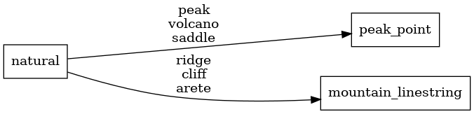
Use the class to differentiate between natural objects.
Possible values:
peakvolcanosaddleridgecliffarete
ele
Elevation (ele) in meters.
ele_ft
Elevation (ele) in feet.
customary_ft
Value 1 for peaks in locations where feet are used as the customary unit (USA).
Possible values:
1None
rank
Rank of the peak within one tile (starting at 1, which is the most important peak).
park


SELECT geometry, class, name, name_en, name_de, NULLIF(tags->'name_int', '') AS "name_int", NULLIF(tags->'name:latin', '') AS "name:latin", NULLIF(tags->'name:nonlatin', '') AS "name:nonlatin", rank FROM layer_park(ST_SetSRID('BOX3D(-20037508.34 -20037508.34, 20037508.34 20037508.34)'::box3d, 3857), 14, 1)The park layer in OpenMapTiles contains natural and protected areas from OpenStreetMap,
such as parks tagged with boundary=national_park,
boundary=protected_area,
or leisure=nature_reserve.
Fields
class
Use the class to differentiate between different kinds of features in the parks layer.
The class for boundary=protected_area parks is the lower-case of the
protection_title
value with blanks replaced by _.
national_park is the class of protection_title=National Park and boundary=national_park.
nature_reserve is the class of protection_title=Nature Reserve and leisure=nature_reserve.
The class for other protection_title
values is similarly assigned.
name
The OSM name value of the park (point features only). Language-specific values are in name:xx.
name_en
English name name:en if available, otherwise name (point features only). This is deprecated and will be removed in a future release in favor of name:en.
name_de
German name name:de if available, otherwise name or name:en (point features only). This is deprecated and will be removed in a future release in favor of name:de.
rank
Rank of the park within one tile, starting at 1, which is the most important park (point features only).
place
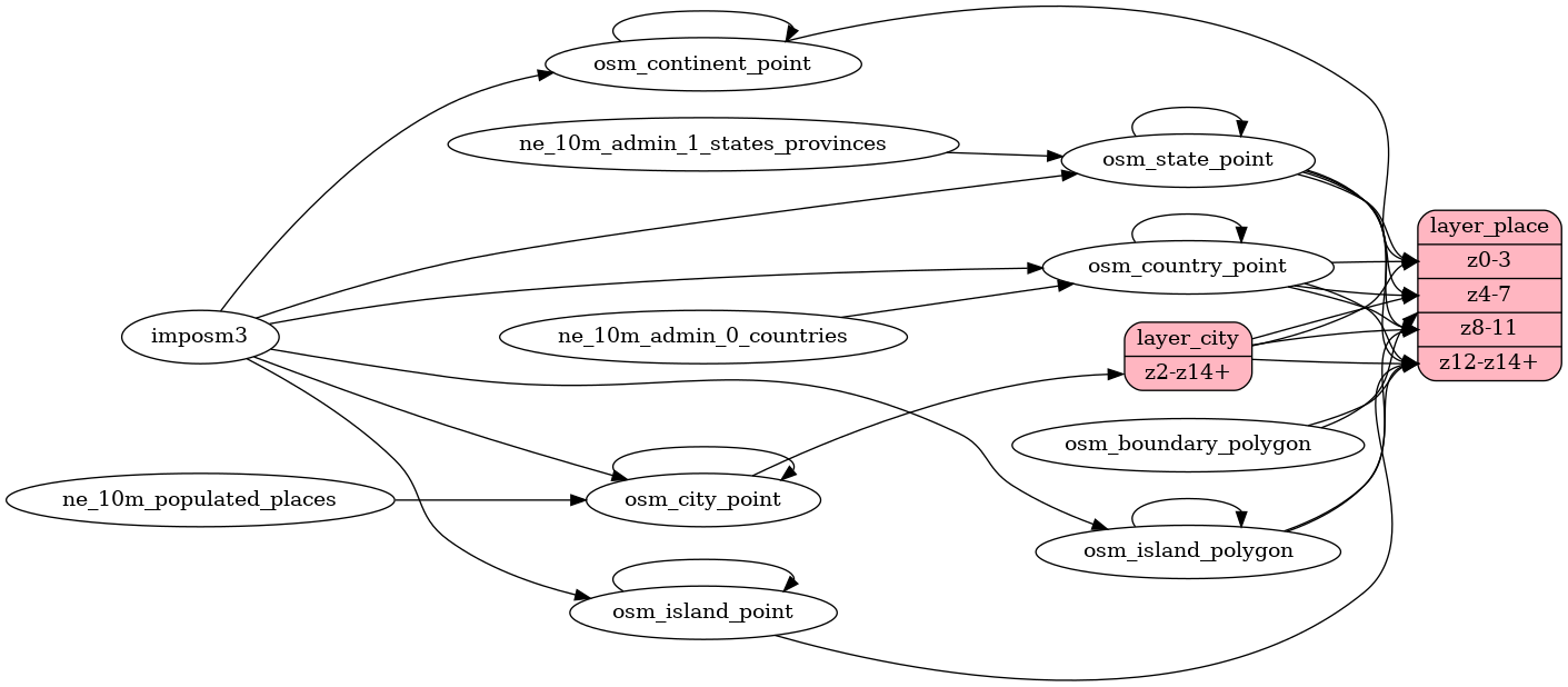
SELECT osm_id, geometry, name, name_en, name_de, NULLIF(tags->'name_int', '') AS "name_int", NULLIF(tags->'name:latin', '') AS "name:latin", NULLIF(tags->'name:nonlatin', '') AS "name:nonlatin", class, rank, capital, iso_a2 FROM layer_place(ST_SetSRID('BOX3D(-20037508.34 -20037508.34, 20037508.34 20037508.34)'::box3d, 3857), 14, 1)The place layer consists of countries, states, cities, and islands. Apart from the roads, this is also one of the more important layers to create a beautiful map. We suggest you use different font styles and sizes to create a text hierarchy.
Fields
name
The OSM name value of the place. Language-specific values are in name:xx.
name_en
English name name:en if available, otherwise name. This is deprecated and will be removed in a future release in favor of name:en.
name_de
German name name:de if available, otherwise name or name:en. This is deprecated and will be removed in a future release in favor of name:de.
capital
The capital field marks the
admin_level
of the boundary the place is a capital of.
Possible values:
23456
class
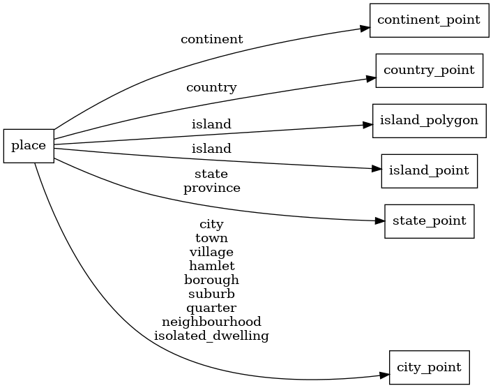
Original value of the
place tag.
Distinguish between continents, countries, states, islands, and
places like settlements or smaller entities.
Use class to separately style the different places and build
a text hierarchy according to their importance. For places derived
from boundaries, the original value of the
boundary tag.
Possible values:
continentcountrystateprovincecitytownvillagehamletboroughsuburbquarterneighbourhoodisolated_dwellingislandaboriginal_lands
iso_a2
Two-letter country code ISO 3166-1 alpha-2. Available only for class=country.
Original value of the
country_code_iso3166_1_alpha_2 tag.
rank
Countries, states, and the most important cities all have a
rank to boost their importance on the map.
The rank field for countries and states ranges from
1 to 6 while the rank field for cities ranges from
1 to 10 for the most important cities
and continues from 10 serially based on the
local importance of the city (derived from population and city class).
You can use the rank to limit the density of labels or improve
the text hierarchy.
For countries and states, the rank value is a combination of the
Natural Earth scalerank, labelrank, and datarank values.
For cities, it consists of a shifted Natural Earth scalerank
combined with a local rank within a grid for cities that do not
have a Natural Earth scalerank.
poi
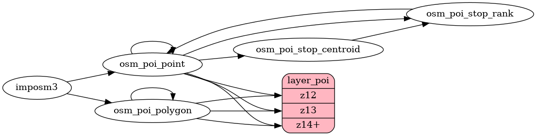

SELECT osm_id, geometry, name, name_en, name_de, NULLIF(tags->'name_int', '') AS "name_int", NULLIF(tags->'name:latin', '') AS "name:latin", NULLIF(tags->'name:nonlatin', '') AS "name:nonlatin", class, subclass, agg_stop, layer, level, indoor, rank FROM layer_poi(ST_SetSRID('BOX3D(-20037508.34 -20037508.34, 20037508.34 20037508.34)'::box3d, 3857), 14, 1)Points of interest containing a variety of OpenStreetMap tags. Mostly contains amenities, sport, shop, and tourist POIs.
Fields
name
The OSM name value of the POI. Language-specific values are in name:xx.
name_en
English name name:en if available, otherwise name. This is deprecated and will be removed in a future release in favor of name:en.
name_de
German name name:de if available, otherwise name or name:en. This is deprecated and will be removed in a future release in favor of name:de.
class
More general classes of POIs. If there is no more general class for the subclass,
this field will contain the same value as subclass.
But for example for schools you only need to style the class school to filter the subclasses school
and kindergarten. Or use the class shop to style all shops.
Possible values:
shopofficetown_hallgolffast_foodparkbusrailwayaerialwayentrancecampsitelaundrygrocerylibrarycollegelodgingice_creampostcafeschoolalcohol_shopbarharborcarhospitalcemeteryattractionbeermusicstadiumart_galleryclothing_storeswimmingcastleatmfuel
subclass
Original value of either the
amenity,
barrier,
historic,
information,
landuse,
leisure,
railway,
shop,
sport,
station,
religion,
tourism,
aerialway,
building,
highway,
office
or waterway
tag. Use this to do more precise styling.
rank
The POIs are ranked ascending according to their importance within a grid. The rank value shows the
local relative importance of a POI within its cell in the grid. This can be used to reduce label density at z14.
Since all POIs already need to be contained at z14, you can use a less than rank=10 expression to limit
POIs. At some point, such as z17, you can show all POIs.
agg_stop
Experimental feature! Indicates the main platform of public transport
stops (buses, trams, and subways). Grouping of platforms is
implemented using the
uic_ref tag, which
is not used worldwide.
Possible values:
1
level
Original value of the level tag.
layer
Original value of the layer tag.
indoor
Original value of the indoor tag.
Possible values:
1
transportation
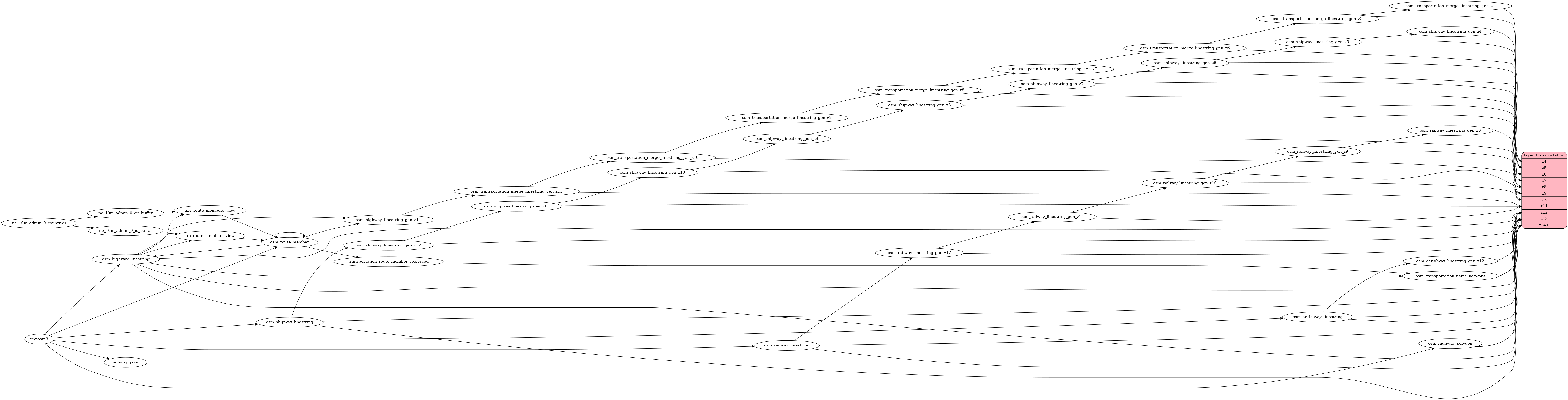
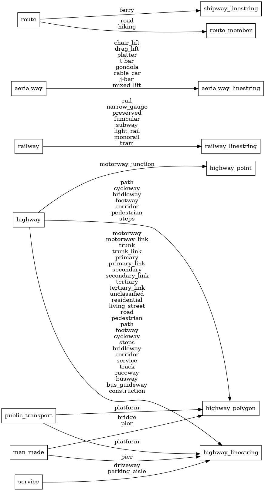
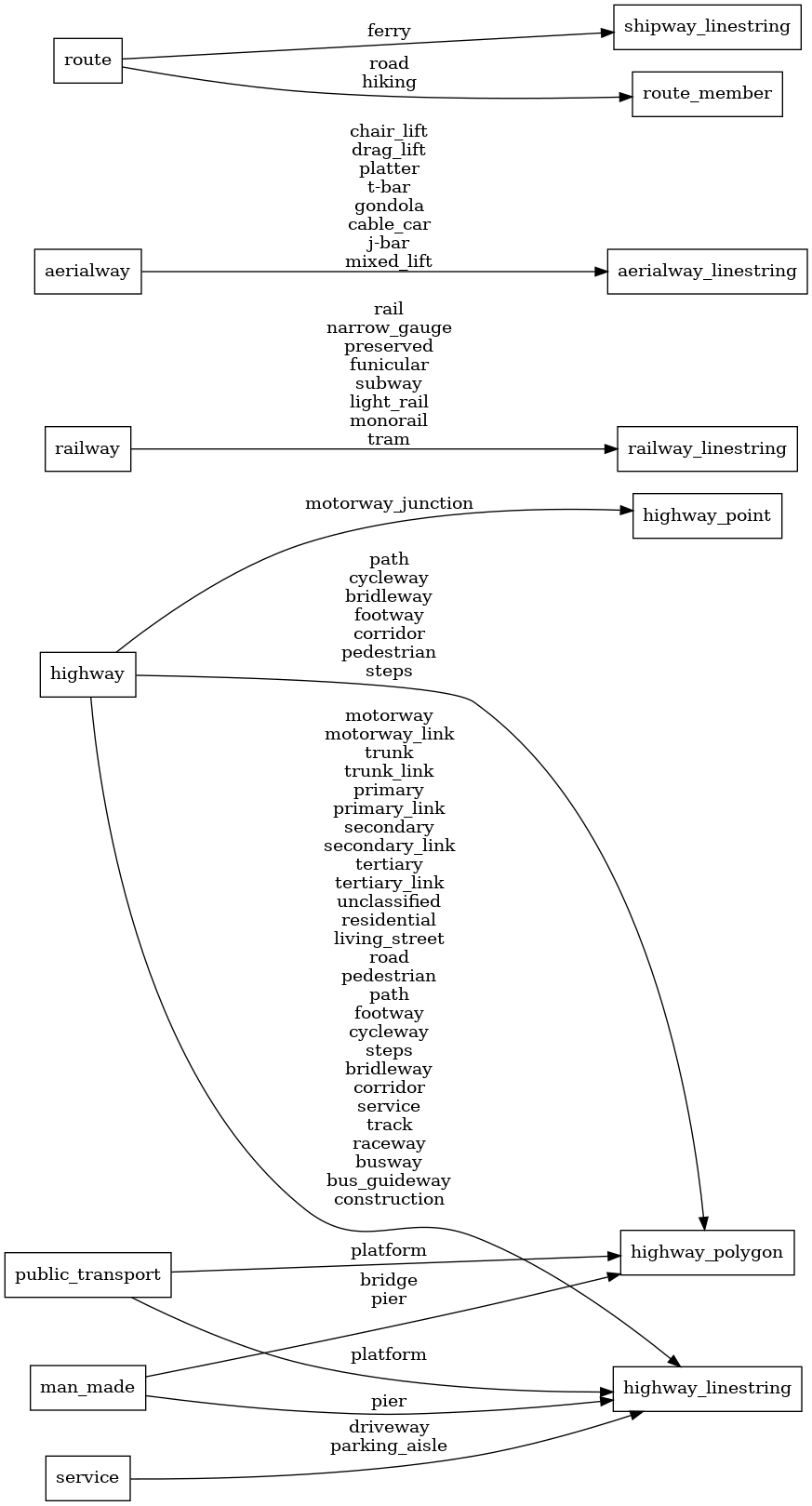
SELECT geometry, class, subclass, network, oneway, ramp, brunnel, service, access, toll, expressway, layer, level, indoor, bicycle, foot, horse, mtb_scale, official, surface FROM layer_transportation(ST_SetSRID('BOX3D(-20037508.34 -20037508.34, 20037508.34 20037508.34)'::box3d, 3857), 14)transportation contains roads, railways, aerial ways, and shipping
lines.
This layer is directly derived from the OSM road hierarchy.
At lower zoom levels, major highways from Natural Earth are used.
It contains all roads from motorways to primary, secondary, and
tertiary roads to residential roads and
footpaths. Styling the roads is the most essential part of the map.
The transportation layer also contains polygons for features like plazas.
Fields
class
Distinguish between more and less important roads or railways and roads under construction.
Class is derived from the value of the
highway,
construction,
railway,
aerialway,
route tag (for
shipping ways),
busway, or
man_made.
Possible values:
motorwaytrunkprimarysecondarytertiaryminorpathservicetrackracewaybuswaybus_guidewayferrymotorway_constructiontrunk_constructionprimary_constructionsecondary_constructiontertiary_constructionminor_constructionpath_constructionservice_constructiontrack_constructionraceway_construction
subclass
Distinguish more specific classes of railway and path:
Subclass is the value of the
railway,
highway (for paths), or
public_transport (for platforms) tag.
Possible values:
railnarrow_gaugepreservedfunicularsubwaylight_railmonorailtrampedestrianpathfootwaycyclewaystepsbridlewaycorridorplatformferry (DEPRECATED - use class)
network
The network type derived mainly from the network tag of the road.
See more info about us-*,
ca-transcanada,
gb-*,
or ie-*.
brunnel
Mark whether the way is a tunnel or bridge.
Possible values:
bridgetunnelford
oneway
Mark with 1 if the way is one-way in the direction of the way,
with -1 if it is one-way in the opposite direction,
and with 0 if it is not one-way.
Possible values:
1-1
ramp
Mark with 1 if the way is a ramp (link or steps),
and with 0 if it is not.
Possible values:
1
service
Original value of the service tag.
Possible values:
spuryardsidingcrossoverdrivewayalleyparking_aisle
access
Access restrictions on this road. Supported values of the
access tag are no and private,
which resolve to no.
Possible values:
False
toll
Whether this is a toll road, based on the toll tag.
Possible values:
01
expressway
Whether this is an expressway, based on the expressway tag.
Possible values:
1
layer
Original value of the layer tag.
level
Experimental feature! Filled only for steps and footways. Original
value of the level tag.
indoor
Experimental feature! Filled only for steps and footways. Original
value of the indoor tag.
Possible values:
1
bicycle
Original value of the bicycle tag (highways only).
foot
Original value of the foot tag (highways only).
horse
Original value of the horse tag (highways only).
mtb_scale
Original value of the mtb:scale tag (highways only).
official
Whether or not a path or trail is official according to the land manager.
Possible values:
01
surface
Values of the surface tag, divided into two groups: paved (paved, asphalt, cobblestone, concrete, concrete:lanes, concrete:plates, metal, paving_stones, sett, unhewn_cobblestone, wood) and unpaved (unpaved, compacted, dirt, earth, fine_gravel, grass, grass_paver, gravel, gravel_turf, ground, ice, mud, pebblestone, salt, sand, snow, woodchips).
Possible values:
pavedunpaved
transportation_name

SELECT geometry, name, name_en, name_de, NULLIF(tags->'name_int', '') AS "name_int", NULLIF(tags->'name:latin', '') AS "name:latin", NULLIF(tags->'name:nonlatin', '') AS "name:nonlatin", ref, ref_length, network::text, class::text, subclass, brunnel, layer, level, indoor, route_1_network, route_1_ref, route_1_name, route_1_colour, route_2_network, route_2_ref, route_2_name, route_2_colour, route_3_network, route_3_ref, route_3_name, route_3_colour, route_4_network, route_4_ref, route_4_name, route_4_colour, route_5_network, route_5_ref, route_5_name, route_5_colour, route_6_network, route_6_ref, route_6_name, route_6_colour FROM layer_transportation_name(ST_SetSRID('BOX3D(-20037508.34 -20037508.34, 20037508.34 20037508.34)'::box3d, 3857), 14)This is the layer for labeling the highways. Only highways that are named name=* and are long enough
to place text upon appear. The OSM roads are stitched together if they contain the same name
to have better label placement than having many small linestrings.
For motorways, you should use the ref field to label them while for other roads you should use name.
Fields
name
The OSM name value of the highway.
name_en
English name name:en if available, otherwise name. This is deprecated and will be removed in a future release in favor of name:en.
name_de
German name name:de if available, otherwise name or name:en. This is deprecated and will be removed in a future release in favor of name:de.
ref
The OSM ref tag of the motorway or its network.
ref_length
Length of the ref field. Useful for having a shield icon as a background for labeling motorways.
network
The network type derived mainly from the network tag of the road.
See more info about us-*,
ca-transcanada,
or gb-*.
Possible values:
us-interstateus-highwayus-stateca-transcanadaca-provincial-arterialca-provincialgb-motorwaygb-trunkgb-primaryie-motorwayie-nationalie-regionalroad (default)
class
Distinguish between more and less important roads and roads under construction.
Possible values:
motorwaytrunkprimarysecondarytertiaryminorservicetrackpathracewaymotorway_constructiontrunk_constructionprimary_constructionsecondary_constructiontertiary_constructionminor_constructionservice_constructiontrack_constructionpath_constructionraceway_constructionrailtransitmotorway_junction
subclass
Distinguish more specific classes of paths:
Subclass is the value of the
highway (for paths),
and “junction” for motorway junctions.
Possible values:
pedestrianpathfootwaycyclewaystepsbridlewaycorridorplatformjunction
brunnel
Mark whether the way is a bridge, a tunnel, or a ford.
Possible values:
bridgetunnelford
level
Experimental feature! Filled only for steps and footways. Original
value of the level tag.
layer
Experimental feature! Filled only for steps and footways. Original
value of the layer tag.
indoor
Experimental feature! Filled only for steps and footways. Original
value of the indoor tag.
Possible values:
1
route_1_network
1st route concurrency network.
route_1_ref
1st route concurrency ref.
route_1_name
1st route concurrency name.
route_1_colour
1st route concurrency color.
route_2_network
2nd route concurrency network.
route_2_ref
2nd route concurrency ref.
route_2_name
2nd route concurrency name.
route_2_colour
2nd route concurrency color.
route_3_network
3rd route concurrency network.
route_3_ref
3rd route concurrency ref.
route_3_name
3rd route concurrency name.
route_3_colour
3rd route concurrency color.
route_4_network
4th route concurrency network.
route_4_ref
4th route concurrency ref.
route_4_name
4th route concurrency name.
route_4_colour
4th route concurrency color.
route_5_network
5th route concurrency network.
route_5_ref
5th route concurrency ref.
route_5_name
5th route concurrency name.
route_5_colour
5th route concurrency color.
route_6_network
6th route concurrency network.
route_6_ref
6th route concurrency ref.
route_6_name
6th route concurrency name.
route_6_colour
6th route concurrency color.
water
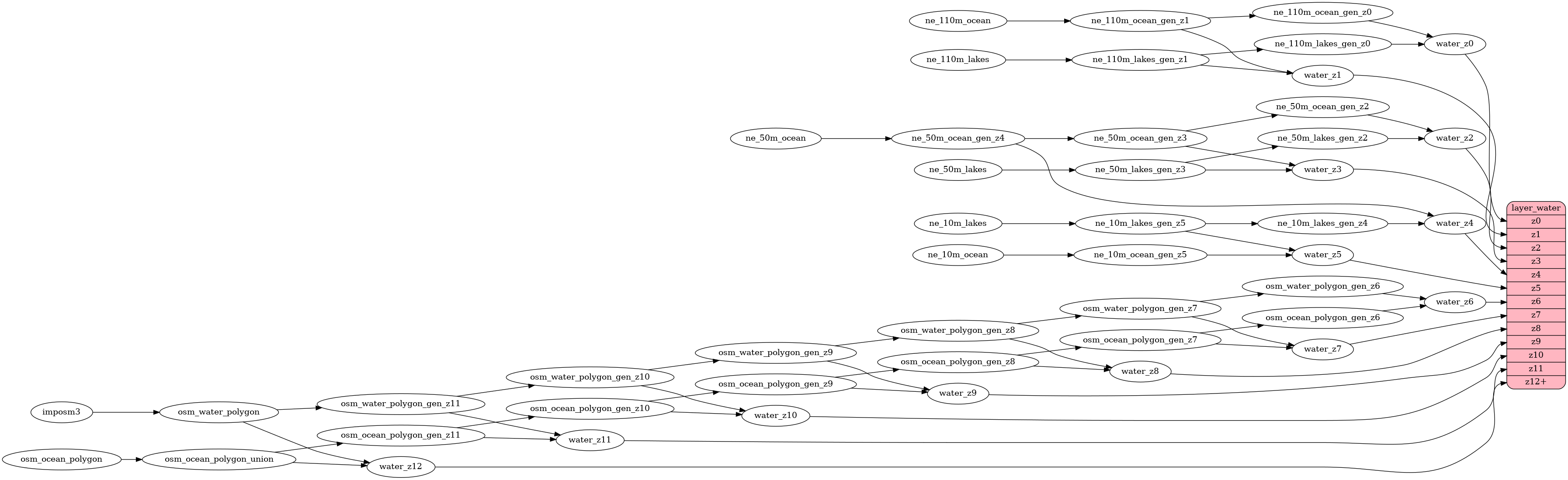
SELECT id, geometry, class, intermittent, brunnel FROM layer_water(ST_SetSRID('BOX3D(-20037508.34 -20037508.34, 20037508.34 20037508.34)'::box3d, 3857), 14)Water polygons representing oceans and lakes. Covered water areas are excluded (covered=yes).
At low zoom levels all water originates from Natural Earth. To get a more correct display of the South Pole you should also
style the covering ice shelves over the water.
On higher zoom levels water polygons from OpenStreetMapData are used.
The polygons are split into many smaller polygons to improve rendering performance.
This, however, can lead to fewer rendering options in clients, since these boundaries show up. So you might not be
able to use border styling for ocean water features.
Fields
id
From zoom 6, OSM IDs are used. Up to zoom 5, Natural Earth lakes are used, with OSM IDs propagated instead of Natural Earth IDs. For areas smaller than the planet, NE lakes keep their Natural Earth IDs.
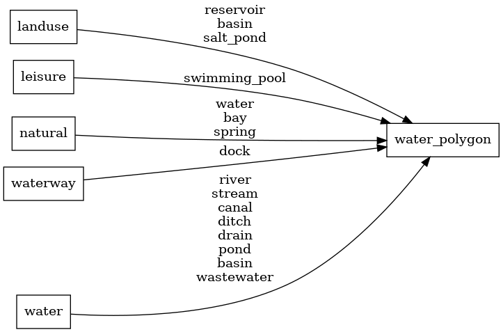
class
All water polygons from OpenStreetMapData have the class ocean.
The water-covered areas of flowing water bodies with the water=river,
water=canal,
water=stream,
water=ditch, or
water=drain tags are classified as river. Wet and dry docks
tagged waterway=dock are classified as dock.
Various minor water bodies are classified as pond.
Swimming pools tagged leisure=swimming_pool are classified as swimming_pool.
All other water bodies are classified as lake.
Possible values:
dockriverpondlakeoceanswimming_pool
intermittent
Mark with 1 if it is an intermittent water polygon.
Possible values:
01
brunnel
Identifies the type of crossing as either a bridge or a tunnel.
Possible values:
bridgetunnel
water_name

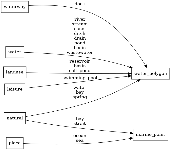
SELECT osm_id, geometry, name, name_en, name_de, NULLIF(tags->'name_int', '') AS "name_int", NULLIF(tags->'name:latin', '') AS "name:latin", NULLIF(tags->'name:nonlatin', '') AS "name:nonlatin", class, intermittent FROM layer_water_name(ST_SetSRID('BOX3D(-20037508.34 -20037508.34, 20037508.34 20037508.34)'::box3d, 3857), 14)Lake centerlines for labeling lakes. This is based on the osm-lakelines project, which derives nice centerlines from OSM water bodies. Only the most important lakes contain labels.
Fields
name
The OSM name value of the water body. Language-specific values are in name:xx.
name_en
English name name:en if available, otherwise name. This is deprecated and will be removed in a future release in favor of name:en.
name_de
German name name:de if available, otherwise name or name:en. This is deprecated and will be removed in a future release in favor of name:de.
class
Distinguish between lake, ocean, bay, strait, and sea.
Possible values:
lakebaystraitseaocean
intermittent
Mark with 1 if it is an intermittent lake.
Possible values:
01
waterway
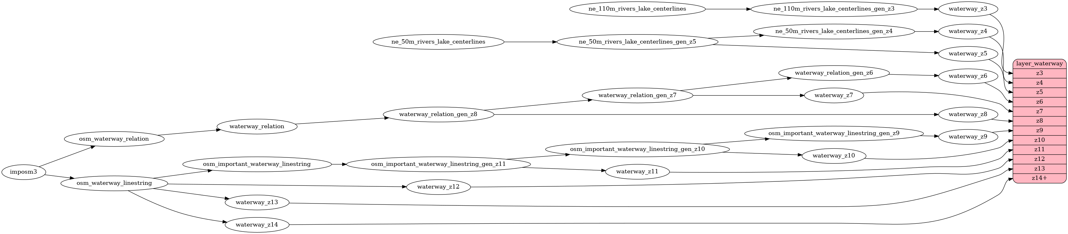
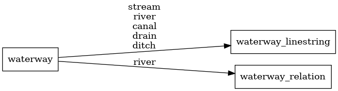
SELECT geometry, name, name_en, name_de, NULLIF(tags->'name_int', '') AS "name_int", NULLIF(tags->'name:latin', '') AS "name:latin", NULLIF(tags->'name:nonlatin', '') AS "name:nonlatin", class, brunnel, intermittent FROM layer_waterway(ST_SetSRID('BOX3D(-20037508.34 -20037508.34, 20037508.34 20037508.34)'::box3d, 3857), 14)OpenStreetMap waterways for higher zoom levels (z9 and more)
and Natural Earth rivers and lake centerlines for low zoom levels (z3-z8).
Linestrings that have no name or are too short are filtered
out at low zoom levels.
Up to z11, only the river class is present; at z12, canal is also generated;
starting at z13, no generalization by class is applied.
Waterways do not have a subclass field.
Fields
name
The OSM name value of the waterway. Language-specific values are in name:xx.
The name field may be empty for Natural Earth data or at lower zoom levels.
name_en
English name name:en if available, otherwise name. This is deprecated and will be removed in a future release in favor of name:en.
name_de
German name name:de if available, otherwise name or name:en. This is deprecated and will be removed in a future release in favor of name:de.
class
The original value of the waterway tag.
Possible values:
streamrivercanaldrainditch
brunnel
Mark whether the way is a tunnel or bridge.
Possible values:
bridgetunnel
intermittent
Mark with 1 if it is an intermittent waterway.
Possible values:
01